 Barbara Mitchell
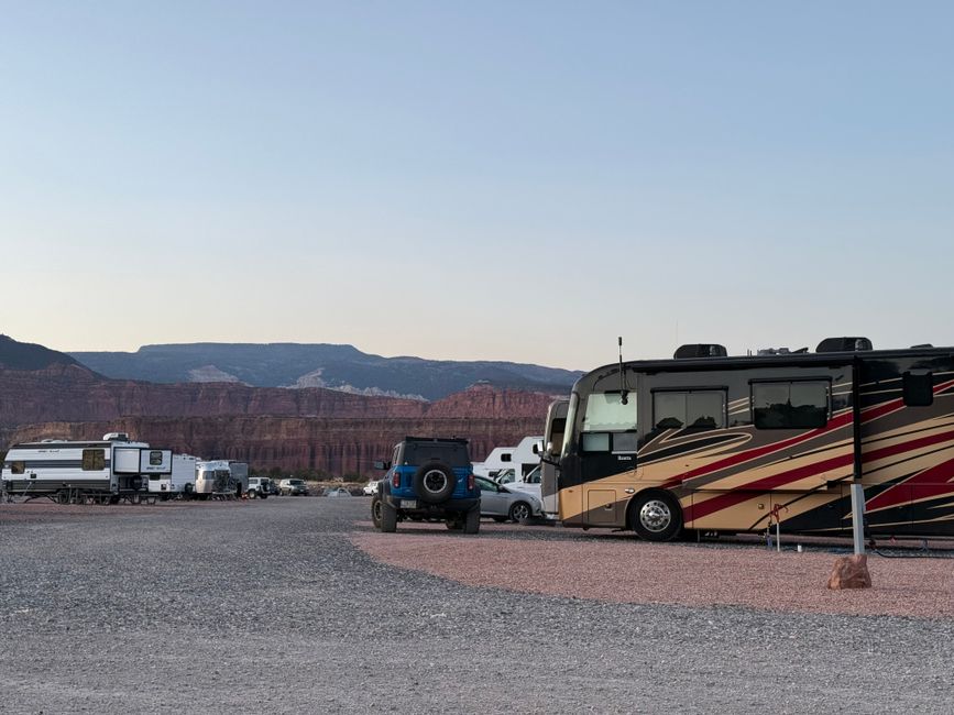
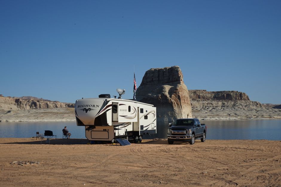
Most people think free camping means roughing it in some dusty lot behind a Walmart. I thought that too, until I spent three weeks in southern Utah on Bureau of Land Management land and realized I was waking up to red rock formations that resort campers were paying $400 a night to see from a lodge window. That’s the thing nobody tells you when you’re just getting started: the free stuff is often the best stuff. Not always, not everywhere, but often enough that once you find your first legitimate boondocking spot, you’ll wonder why you ever paid for a full-hookup site at a noisy commercial campground.
I’ve spent eight years finding free land, making mistakes, getting stuck (literally, once, in New Mexico clay after a rainstorm), and slowly building a mental map of where the real opportunities are. This isn’t a list I scraped from the internet. These are the systems and sources that actually work.
Each federal land agency enforces different dispersed camping rules-knowing these before you arrive prevents fines and forced relocations.
| Land Type | Typical Stay Limit | Distance Rule | Permit Required? | Key Restrictions |
|---|---|---|---|---|
| BLM (Standard Areas) | 14 days per 28-day period | 25-100 ft from water | No (most areas) | Must move 25+ miles after limit; no dumping gray water |
| BLM Long-Term Visitor Areas (AZ/CA) | Up to 7 months (seasonal) | Designated sites only | Yes ($40-$180/season) | Only 9 locations exist; dates vary Sept-April |
| National Forest (Dispersed) | 14 days per 30-day period | 200 ft from water/roads | No (most forests) | Fire restrictions vary; some forests require free fire permits |
| National Grasslands | 14 days | Varies by unit | No | Often fewer restrictions than forests; less crowded |
| Army Corps of Engineers | 14 days (free areas rare) | Designated areas only | Sometimes | Most sites are developed with fees; dispersed limited |
| State Trust Lands (AZ, NM, UT) | 14 days typical | Varies | Yes ($15-$35/year) | Recreational permit required; not all states allow camping |
| Wildlife Management Areas | Often prohibited or hunt-season only | N/A | Varies | Many WMAs ban overnight stays entirely |
General information for comparison, confirm specifics for your situation.
What “Free Camping” Actually Means (and What It Doesn’t)
Let me clear up the vocabulary first, because people confuse these terms constantly and that’s when problems start.
Boondocking means camping without hookups, usually off-grid, often on public land. It’s a catch-all that covers everything from a legal dispersed campsite on national forest land to dry camping in a casino parking lot. Here’s the thing people get wrong: boondocking doesn’t automatically mean free. You can boondock on private land that costs money. You can also camp for free in a developed campground if you stay off the grid.
Dispersed camping is specific. The Forest Service and BLM use this term to mean camping outside designated campground areas on lands that permit it. Most of the time, it’s free. The rules are straightforward: stay at least 200 feet from water sources and roads, leave no trace, follow the 14-day stay limit. That last one gets enforced harder than people expect. I’ve had rangers knock on my door at day 13 to politely remind me the clock was ticking.
Day-use only areas aren’t boondocking spots, period. I’ve watched people set up camp in areas clearly marked for day use only and watched rangers issue citations afterward. Those fines are genuinely expensive.
Free camping exists in abundance across the United States. The catch is knowing which land category you’re on and what that category’s rules actually are. Assuming it’s okay is how you get a $500 ticket or, worse, how you damage something sensitive that then gets closed to everyone.
The Big Three: BLM, National Forests, and Grasslands
These three federal land categories are where boondocking actually happens. They cover a staggering amount of territory.
Bureau of Land Management land is the foundation of this whole thing. The BLM manages 245 million acres, mostly in western states. Arizona, Nevada, Utah, Colorado, New Mexico, Idaho, Montana, Wyoming, Oregon, California: these are your playgrounds. The concentration in the Southwest is why you see so many full-time RVers migrate west every fall. Places like Quartzsite, Arizona become temporary cities of dispersed campers every January, with tens of thousands of rigs legally parked on open desert for free (or for a nominal Long Term Visitor Area fee of around $180 for the season).
National Forests are managed by the U.S. Forest Service, and dispersed camping is allowed on most of them unless specifically posted otherwise. The real difference from BLM: you’re usually in mountains and trees rather than desert. That means cooler temperatures but also worse cell signal and sometimes rougher roads. I’ve had some of my best Colorado summers parked in a national forest at 9,000 feet, paying nothing, with temperatures 30 degrees cooler than the valley below.
National Grasslands get completely ignored. They’re Forest Service land, dispersed camping is allowed, and because nobody talks about them, they’re often empty. The Kiowa National Grassland in New Mexico. The Thunder Basin in Wyoming. The Sheyenne in North Dakota. I’ve had 360-degree views with zero neighbors in places most people just drive through.
What I discovered when I got serious about this: most of this land is poorly marked on the ground. Digital tools make all the difference.
The Apps and Resources That Actually Work
Here’s the honest part: finding great spots versus driving an hour down a bad road to nowhere comes down almost entirely to which tools you use.
onX Offroad (formerly onX Maps) is what I use most. It layers land ownership data over satellite imagery with offline GPS tracking. When I’m scoping a new area, I can see exactly where BLM land starts, where private land is, and what other users have reported about road conditions. It’s not free, around $30 a year for the basic tier, but it’s worth every dollar.
Freecampsites.net is a crowd-sourced database with user reviews, GPS coordinates, and road condition notes. The quality varies by region. Popular spots in Arizona or California have dozens of reviews. Remote spots in North Dakota might have two. I use it as a starting point, then verify everything with onX.
The Dyrt works similarly with a solid free tier. Their PRO version runs around $36 a year and unlocks offline maps plus more detailed filters. Their user community is genuinely active.
iOverlander focuses more on overlanding and international travel but has good coverage of remote U.S. spots, especially if you’re running smaller rigs or trucks.
Recreation.gov is essential for any managed dispersed areas requiring permits, which is becoming more common. The Coconino National Forest around Sedona, Arizona, now requires a Red Rock Pass and limits dispersed camping to specific zones. Always check the local forest or BLM field office website before you commit to a trip.
One resource I lean on that people never mention: call the local BLM field office directly. Tell them your rig size (a 40-foot fifth wheel and a 22-foot van have completely different access), when you’re coming, and ask what’s currently open and accessible. I’ve gotten specific GPS coordinates from rangers who were genuinely happy to point me somewhere good. They know the land better than any app.
Step-by-Step: How I Scout a New Boondocking Spot
This is my actual process.
Pick a region and a window. I don’t search “free camping near me.” I decide where I want to be, roughly when, and whether I’m looking for desert, mountains, or forest. Elevation changes temperature dramatically in both directions.
Open onX and identify public land. I look for large contiguous blocks of BLM or Forest Service land with road access. I zoom into satellite view to see terrain, tree cover, and whether clearings or tracks suggest previous campers have been there.
Cross-reference Freecampsites.net. I look up that GPS area and read reviews, paying close attention to rig size notes and recent road condition reports. Reviews from more than two years ago mean almost nothing, especially after wet winters that destroy dirt roads.
Check the managing agency’s website. BLM field offices and national forests post closure notices, fire restrictions, and any new permit requirements. Five minutes and I’ve saved myself from driving 200 miles to a closed area more than once.
Look at the route, not just the destination. I use Google Street View at the turnoff from the paved road. If Street View doesn’t go there (common), I look at satellite imagery and measure the road width. A road that looks fine for a Jeep can be disastrous for a 35-foot Class A.
Call or check the forecast. Clay roads in the Southwest go from hard-packed to impassable in 20 minutes of rain. I don’t go down an unfamiliar dirt road if there’s more than a 20% chance of rain in the next 48 hours. That’s how I learned my lesson in New Mexico.
Arrive with a backup spot identified. I always have a Plan B loaded in my GPS before I leave pavement. Sometimes the spot is taken, sometimes there’s a new closure sign, sometimes the road is worse than expected.
Beyond Federal Land: Other Free Camping Options That Hold Up
Federal land is the headline, but there’s more.
State land and trust land varies wildly by state. In Arizona, State Trust Land requires a recreational permit ($15/year for individuals) and you can camp dispersed on much of it. Montana has similar programs. Other states are far more restrictive. Research your specific state’s land department.
Corps of Engineers land around reservoirs and waterways often allows free or very low-cost dispersed camping. The consistency is spotty, but genuinely beautiful waterfront spots exist this way. The COE website has a campground locator that includes dispersed areas.
Extended stay parking at Walmart, Cracker Barrel, casinos is real but I’d call it a travel tool, not a destination. It’s useful when you’re moving between spots and need to stop overnight. Call ahead and ask permission; don’t assume. Policies have tightened in recent years and vary by individual store.
Harvest Hosts isn’t free at $99/year, but it buys you access to a network of wineries, farms, breweries, and attractions that let members stay overnight. It’s a different vibe, not boondocking exactly, but worth mentioning because the stays are often genuinely memorable and the cost per night works out to almost nothing if you use it regularly.
For off-grid stays to actually work, the gear matters. A quality solar panel setup and lithium battery bank change everything about how long you can comfortably stay off-grid. A battery monitor is something I consider non-negotiable; guessing your state of charge is a recipe for waking up with a dead system. A quality water filter matters too if you’re hauling water rather than relying on hookups.
(Disclosure: this site may earn a commission on qualifying purchases through the links above.)
What Nobody Tells You About Free Camping Realities
Sources
I’d be doing you a disservice if I made this sound effortless.
Cell signal is genuinely bad in most of the best boondocking spots. I’ve adapted. I download offline maps and entertainment in advance, I schedule check-ins with family using Garmin inReach messaging, and I’ve learned to actually enjoy disconnecting. But if you work remotely and need consistent internet, you’ll need a Starlink and even that has limitations depending on obstructions.
The 14-day stay limit is real and enforced in popular areas. This is the biggest misconception I see from new boondockers. You cannot park in Quartzsite indefinitely without paying for a Long Term Visitor Area permit. Rangers do drive through and document rigs. After 14 days on any single BLM or Forest Service dispersed area, you must move at least 25 miles away before returning.
Roads will test your rig. Not in a dramatic way every time, but rough dirt road driving adds up over years. Check your wheel lug torques after any significant off-pavement driving. Watch your tire sidewalls. Bring a quality leveling system because many dispersed sites aren’t flat.
Fire restrictions change constantly in summer and fall across the West. An area that’s legal to camp in can prohibit all fires and sometimes even generators during red flag conditions. Check current restrictions at the managing agency’s website every single time, not just when you first research the spot.
Eight years in, my mental map of free camping spots covers most of the western U.S. and patches of the southeast and midwest. I’m still adding to it. Every region has something, if you know how to look and you’re willing to do 20 minutes of research before you drive. The people paying $65 a night at a crowded campground with thin walls between sites aren’t getting a better experience. They’re getting a more predictable one. Once you’re comfortable with a little uncertainty and a backup plan in your GPS, the math changes entirely.